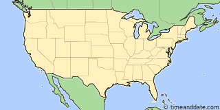
| Country: | United States |
|---|---|
| Lat/Long: | 47°11'N / 122°16'W |
| Currency: | United States Dollar (USD) |
| Languages: | English |
| Country Code: | N/A |

More Sun & Moon in 47°11'13.1"N, 122°15'51.8"W
+ Show More Twilight and Moon Phase Information
Solar Noon
Sun in South: 1:05 pm
Altitude: 62.4°
Altitude: 62.4°
Astronomical
Twilight
3:06 am – 4:05 am
10:06 pm – 11:06 pm
10:06 pm – 11:06 pm
Nautical
Twilight
4:05 am – 4:53 am
9:18 pm – 10:06 pm
9:18 pm – 10:06 pm
Civil
Twilight
4:53 am – 5:29 am
8:41 pm – 9:18 pm
8:41 pm – 9:18 pm
Previous
Moon Phase
First Quarter
May 15, 2024
4:48 am
May 15, 2024
4:48 am
Next
Moon Phase
Full Moon
May 23, 2024
6:53 am
May 23, 2024
6:53 am

Airports
- Seattle–Tacoma International Airport, SEA
About 18 mi N of 47°11'13.1"N, 122°15'51.8"W - Boeing Field, BFI
About 24 mi N of 47°11'13.1"N, 122°15'51.8"W - Kenmore Air Harbor Seaplane Base, LKE
About 31 mi N of 47°11'13.1"N, 122°15'51.8"W

47°11'13.1"N, 122°15'51.8"W
USA
9:1244pm
Friday, May 17, 2024


