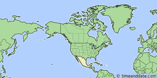
| Country: | Mexico | ||
|---|---|---|---|
| State: | Zacatecas (ZA) | ||
| Type: | Hill | ||
| Lat/Long: | 23°28'N / 102°45'W | ||
| Currency: | Mexican Peso (MXN) | ||
| Languages: | Spanish, Nahuatl, Yucatec Maya, … | ||
| Also known as: | Cerro Sacramento |


Holiday Note: Jun 2, General Election Day. Businesses may be closed. See more
°F
Weather
68 °F
Passing clouds.
89 / 58 °F
| Fri 31. | 90 / 57 °F | |
| Sat 1. | 89 / 59 °F |
Weather by CustomWeather, © 2024
More Sun & Moon in Cerro Sacramento
+ Show More Twilight and Moon Phase Information
Solar Noon
Sun in South: 12:48 pm
Altitude: 88.5°
Altitude: 88.5°
Astronomical
Twilight
4:38 am – 5:09 am
8:27 pm – 8:58 pm
8:27 pm – 8:58 pm
Nautical
Twilight
5:09 am – 5:39 am
7:58 pm – 8:27 pm
7:58 pm – 8:27 pm
Civil
Twilight
5:39 am – 6:04 am
7:32 pm – 7:58 pm
7:32 pm – 7:58 pm
Previous
Moon Phase
Full Moon
May 23, 2024
7:53 am
May 23, 2024
7:53 am
Next
Moon Phase
Third Quarter
May 30, 2024
11:12 am
May 30, 2024
11:12 am

Calendar & Holidays
Upcoming Holidays

Airports
- General Leobardo C. Ruiz International Airport, ZCL
About 40 mi S of Cerro Sacramento - Lic. Jesús Terán Peredo International Airport, AGU
About 125 mi SSE of Cerro Sacramento - General Guadalupe Victoria International Airport, DGO
About 122 mi WNW of Cerro Sacramento - Don Miguel Hidalgo y Costilla International Airport, GDL
About 206 mi S of Cerro Sacramento

Cerro Sacramento
Mexico
4:2054am
Thursday, May 30, 2024


