| Global Event: | Total Lunar Eclipse |
|---|---|
| Local Type: | Total Lunar Eclipse in Chiricahua National Monument, Arizona |
| Begins: | Mon, Jun 25, 2029 at 7:21 pm |
| Maximum: | Mon, Jun 25, 2029 at 8:22 pm 1.843 Magnitude |
| Ends: | Mon, Jun 25, 2029 at 11:09 pm |
| Duration: | 3 hours, 48 minutes | All times shown on this page are local time. |
June 25, 2029 — Total Lunar Eclipse — Chiricahua National Monument
Live Eclipse Animation will start at:
Live Eclipse Animation has ended.
You are using an outdated browser, to view the animation please update or switch to a modern browser.
The animation shows what the eclipse approximately looks like. Stages and times of the eclipse are outlined below.
| Time | Phase | Event | Direction | Altitude |
|---|---|---|---|---|
| 5:34 pm Mon, Jun 25 | Not directly visible | Penumbral Eclipse begins Below horizon | -21.0° | |
| 6:32 pm Mon, Jun 25 | Not directly visible | Partial Eclipse begins Below horizon | -9.9° | |
| 7:21 pm Mon, Jun 25 | Rising | Moonrise Rising, but the combination of a very low moon and the total eclipse phase will make the moon so dim that it will be extremely difficult to view until moon gets higher in the sky or the total phase ends. | -0.2° | |
| 7:31 pm Mon, Jun 25 | Total Eclipse begins Total moon eclipse starts - completely red moon. Moon close to horizon, recommend going to a high point. Additionally, the eclipsed moon combined with dimming near horizon might make the Moon very hard or impossible to see. | 1.3° | ||
| 8:22 pm Mon, Jun 25 | Maximum Eclipse Moon is closest to the center of the shadow. | 9.8° | ||
| 9:13 pm Mon, Jun 25 | Total Eclipse ends Total moon eclipse ends. | 17.7° | ||
| 10:11 pm Mon, Jun 25 | Partial Eclipse ends Partial moon eclipse ends. | 25.5° | ||
| 11:09 pm Mon, Jun 25 | Penumbral Eclipse ends The Earth's penumbra ends. | 31.1° |
How to use altitude & direction to find in the sky
The curvature of the shadow's path and the apparent rotation of the Moon's disk is due to the Earth's rotation.

Cloud Coverage (Jun 25)
In the past, this day was cloudy 18% of the time (since 2000).
Lunar Eclipses
- When Is the Next Lunar Eclipse?
- Total Lunar Eclipse
- Why Does the Moon Turn Red?
- Partial Lunar Eclipse
- Penumbral Lunar Eclipse
- Can I See a Lunar Eclipse?
- Blood Moon - Total Lunar Eclipse
- Eclipse Seasons
- What Is a Tetrad?
- Magnitude of Eclipses
- Accuracy of Our Eclipse Calculations
- Why Two Dates for a Lunar Eclipse?
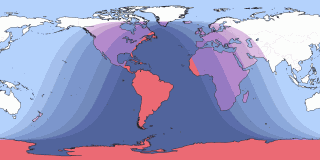
Eclipses and Transits Visible in Chiricahua National Monument
| Eclipse Visibility From Chiricahua National Monument | Visibility Worldwide | ||
|---|---|---|---|
| Mar 3, 2026 Total Lunar Eclipse | Total Lunar Eclipse |  | |
| Aug 27–28, 2026 Partial Lunar Eclipse | Partial Lunar Eclipse |  | |
| Feb 20, 2027 Penumbral Lunar Eclipse | Penumbral Lunar Eclipse |  | |
| Aug 16–17, 2027 Penumbral Lunar Eclipse | Penumbral Lunar Eclipse |  | |
| Jan 11, 2028 Partial Lunar Eclipse | Partial Lunar Eclipse |  | Note: Click on the date link for details in Chiricahua National Monument, or the path map image for global details. |
Next annular eclipse visible in Chiricahua National Monument