| Global Event: | Total Lunar Eclipse |
|---|---|
| Local Type: | Penumbral Lunar Eclipse in Pacific Pines State Park, Washington |
| Begins: | Thu, Dec 20, 2029 at 4:32 pm |
| Maximum: | Thu, Dec 20, 2029 at 4:35 pm -0.106 Magnitude |
| Ends: | Thu, Dec 20, 2029 at 5:41 pm |
| Duration: | 1 hour, 9 minutes | All times shown on this page are local time. |
December 20, 2029 — Total Lunar Eclipse — Pacific Pines State Park
Live Eclipse Animation will start at:
Live Eclipse Animation has ended.
You are using an outdated browser, to view the animation please update or switch to a modern browser.
The animation shows what the eclipse approximately looks like. Stages and times of the eclipse are outlined below.
| Time | Phase | Event | Direction | Altitude |
|---|---|---|---|---|
| 11:42 am Thu, Dec 20 | Not directly visible | Penumbral Eclipse begins Below horizon | -20.9° | |
| 12:55 pm Thu, Dec 20 | Not directly visible | Partial Eclipse begins Below horizon | -20.5° | |
| 2:15 pm Thu, Dec 20 | Not directly visible | Total Eclipse begins Below horizon | -16.0° | |
| 2:42 pm Thu, Dec 20 | Not directly visible | Maximum Eclipse Below horizon | -13.7° | |
| 3:08 pm Thu, Dec 20 | Not directly visible | Total Eclipse ends Below horizon | -11.0° | |
| 4:28 pm Thu, Dec 20 | Not directly visible | Partial Eclipse ends Below horizon | -0.6° | |
| 4:32 pm Thu, Dec 20 | Rising | Moonrise Rising | -0.2° | |
| 4:35 pm Thu, Dec 20 | Maximum in Pacific Pines State Park This is the moment when the eclipse reaches its greatest magnitude while the entire Moon is above the horizon in Pacific Pines State Park. The true maximum point of this eclipse cannot be seen in Pacific Pines State Park because the Moon is below the horizon at that time. Since the Moon is near the horizon at this time, we recommend going to a high point or finding an unobstructed area with free sight to Northeast for the best view of the eclipse. | 0.2° | ||
| 5:41 pm Thu, Dec 20 | Penumbral Eclipse ends The Earth's penumbra ends. Moon close to horizon, so make sure you have free sight to East-northeast. | 9.3° |
How to use altitude & direction to find in the sky
The curvature of the shadow's path and the apparent rotation of the Moon's disk is due to the Earth's rotation.

Cloud Coverage (Dec 20)
In the past, this day was cloudy 79% of the time (since 2000).
Lunar Eclipses
- When Is the Next Lunar Eclipse?
- Total Lunar Eclipse
- Why Does the Moon Turn Red?
- Partial Lunar Eclipse
- Penumbral Lunar Eclipse
- Can I See a Lunar Eclipse?
- Blood Moon - Total Lunar Eclipse
- Eclipse Seasons
- What Is a Tetrad?
- Magnitude of Eclipses
- Accuracy of Our Eclipse Calculations
- Why Two Dates for a Lunar Eclipse?
Eclipses and Transits Visible in Pacific Pines State Park
| Eclipse Visibility From Pacific Pines State Park | Visibility Worldwide | ||
|---|---|---|---|
| Mar 3, 2026 Total Lunar Eclipse | Total Lunar Eclipse |  | |
| Aug 27–28, 2026 Partial Lunar Eclipse | Partial Lunar Eclipse |  | |
| Aug 16–17, 2027 Penumbral Lunar Eclipse | Penumbral Lunar Eclipse |  | |
| Jan 11, 2028 Partial Lunar Eclipse | Partial Lunar Eclipse |  | |
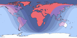
| Dec 31, 2028 Partial Lunar Eclipse | Total Lunar Eclipse |  | Note: Click on the date link for details in Pacific Pines State Park, or the path map image for global details. |
Next total solar eclipse visible in Pacific Pines State Park
Next annular eclipse visible in Pacific Pines State Park